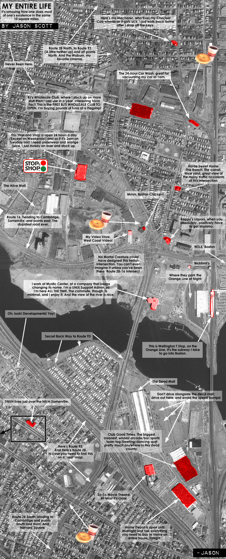
So now you're wondering why I did this.
Well, I found an excellent site out on the Internet called the MIT Orthographic Server which provides satellite maps of the entire Boston area, incredibly easy to browse and zoom around, although they are several years old. (In other words, don't go to Harvard Yard and wave. It won't work.) Regardless, most of the important landmarks are still in these pictures, and a little careful browsing, capturing, and stitching together provides wonderful images for the budding satellite photo artist.
I noticed that in fact, I spend 90 percent of my time among my home and work and the places in between. This graphic proved it.